

History under X-ray: XRF applied to source criticism
March 21, 2023
How often, in front of a mysterious historical find, would one want to look inside it, make it “speak” more than it does, investigate it deeply? Today this is possible.
An insufficient but almost necessary condition for any historical reconstruction, source criticism makes use of the so-called auxiliary disciplines, the number of which has been enriched as human knowledge has progressed over time: from cartography to numismatics, via paleography and anthropology.
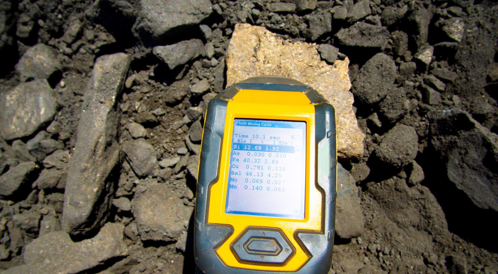
To these it has been added, since the first pioneering studies in 1928, an analysis technique known as XRF spectrophotometry. While the name may appear intimidating, it is sufficient to break it down to understand its meaning: the acronym XRF refers in English to X-Ray Fluorescence, that is, the emission of X-rays by specific substances the electrons of which are excited by gamma rays or high-energy X-Rays.
Spectrophotometry is nothing more than the study of the spectrum in which such radiation may be dispersed: depending on the atom from which it comes, the emitted radiation will have a different wavelength. Thus, it is enough to analyze which spectral lines are formed to recognize from which chemical elements the irradiated object is composed, at least from a certain atomic weight upwards.
Although the procedure is rather user-friendly, it still involves irradiating an object with this kind of electromagnetic radiation: it would seem problematic to apply it to delicate materials such as historical documents can be.
In fact, the main advantage of XRF spectrophotometry is precisely its nondestructive nature: as a rule, it is used a radiation that excites almost exclusively the core electrons, i.e., those located on the orbitals closest to the atomic nucleus and that generally do not affect chemical bonds.
Precisely for this reason, the technique is now also used in the archaeological field: in a New York Met study published in 2021, for example, XRF was used to investigate the geographical origin of turquoise stones found in some Egyptian and Near Eastern artifacts.
Knowing the elemental composition of an object, however, is not only instrumental to its description but also to ascertaining its authenticity: in 2009, researchers at the University of Lisbon analyzed ancient texts, checking the correspondence between the ink used in the text and the ink in the signature.
Part of the Lisbon team then participated in an analysis, published in 2017, of the so-called third secret of Fátima: Sister Lúcia Santos, one of the three children who witnessed the supposed apparition in 1917, allegedly recorded the Virgin’s words in some documents dated 1941-44.
Only the first two parts were revealed to the public, though, while the third was kept hidden by the Vatican until 2000, when John Paul II opted for its disclosure, raising at the same time several inferences that the revealed document was not Sister Lúcia’s authentic manuscript.
The 2017 study employs micro-XRF spectrophotometry (which channels a reduced beam of rays onto a narrow surface) to compare the paper and ink of the Third Secret of Fátima with those of other manuscripts by the same author.
Despite the documents are made of different paper materials, they are all written in zinc-based ink, and the third secret shows no evidence of erasure or manipulation.
A more elaborate story is that of the so-called Map of Vinland, a planisphere sold in 1957 to Yale University by philanthropist Paul Mellon, who had purchased it from antiquarian Laurence Witten.
The map, supposed to be dated to the early fifteenth century, showed a land west of the Atlantic Ocean called Vinilanda: the reference is to the Vinland mentioned by some thirteenth-century Norse sagas along with Helluland and Markland, identified with Eastern Canada.
The map was by no means the only evidence of Viking landing in North America in the 11th century AD (in addition to the Norse sagas, as attested by some medieval historians and an archaeological find), but it seemed to constitute the earliest European representation of America.
Contributing to its authenticity were woodworm holes, which demonstrated the past contiguity between the map and two real medieval documents.
However, there were also numerous suspicious elements, if not downright anachronistic elements: from the accuracy of the Greenland coastline to the near-centrality of the Atlantic, to an error in the Latin indication of cardinal points. Between 2013 and 2018 it was discovered that the map turns out to be inspired by an 18th-century planisphere.
What finally settled the issue was the ink: as early as 1973, the presence of anatase, a titanium dioxide used commercially in inks only since the 1920s, was detected, but only XRF spectrophotometry ended the debate.
In fact, Yale itself in 2021 confirmed the presence of anatase in the ink of the map with this technique, but it also proved the malicious nature of the historical fake: on the back of the map, “part one” in modern ink was added to the original title of one of the two enclosed medieval texts.
The map is thus a 20th-century fake, written on originally blank sheets of paper attached to two authentic documents.
XRF spectrophotometry has limitations, however, and it is Vinland’s map that shows how the “hard sciences” and other disciplines auxiliary to history sometimes work best together. In fact, as Paolo Chiesa pointed out, philologists and paleographers could have shown the “questionability of the history accuracy” of the map from the very beginning, if asked.
The author/s
Related articles