
So it was, if you like
December 20, 2021
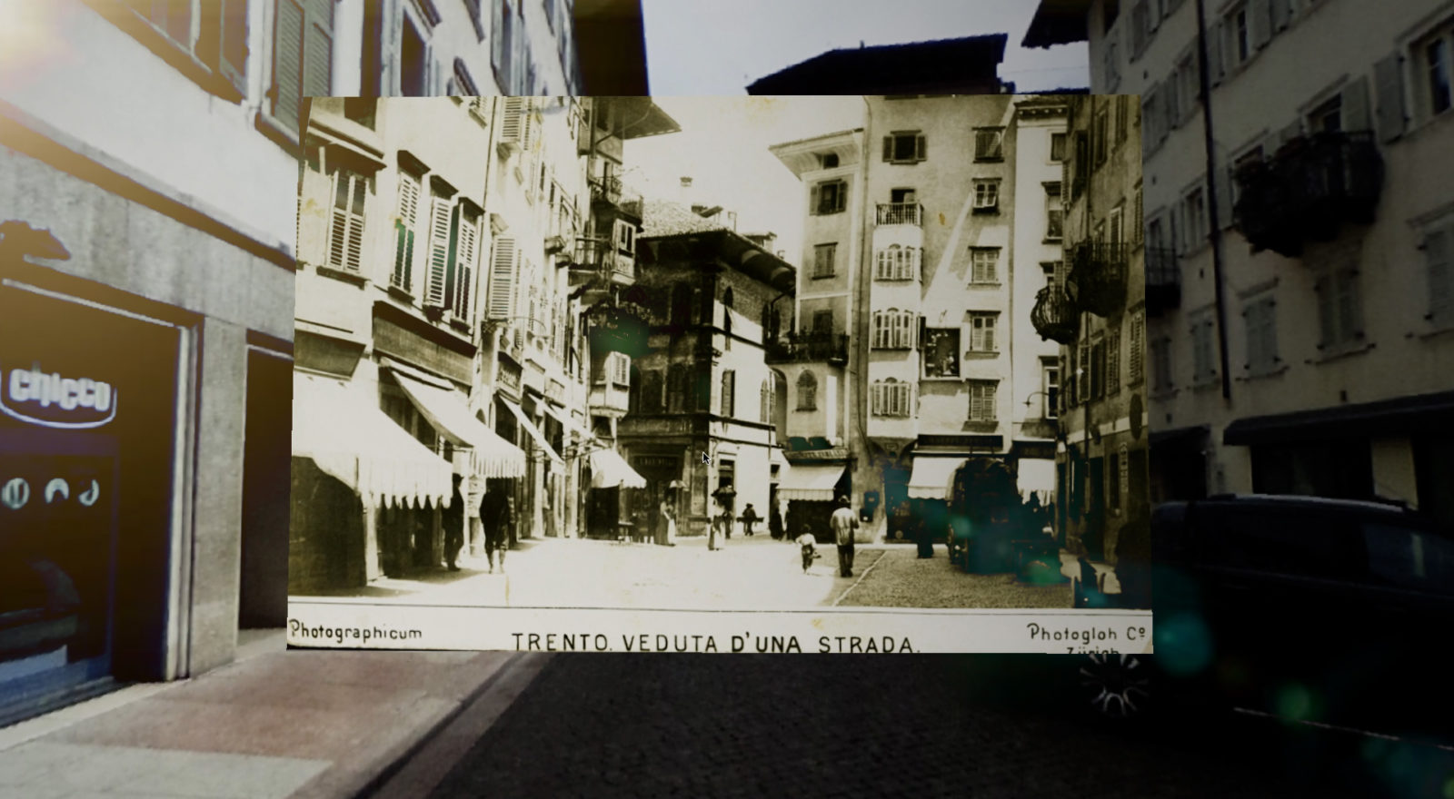
TOTEM: A dip into the past through the eyes of the present and with the help of 3D
With the contribution of the CARITRO Foundation, TOTEM is a project that involved the 3DOM (3D Optical Metrology) research unit of FBK and its researcher Elisa Mariarosaria Farella for the realization of a web platform and an augmented reality (AR) application for the rediscovery of Trento in the last 150 years, told through its photographs and historical maps.
The web platform is divided into three macro-sections that allow an innovative use of archival and cadastral data.
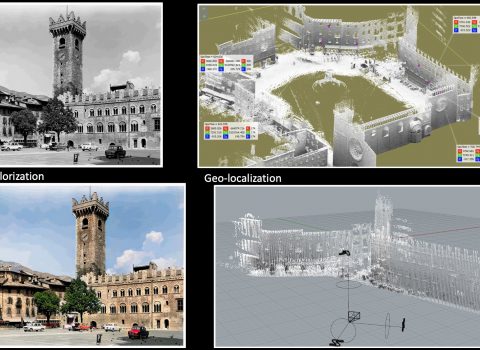
The first module is dedicated to the visualization of historical photographs that have captured events and transformations of Trento in the twentieth century. The georeferenced historical images, superimposed on panoramic images that tell the current city, are enriched with transparency effects, automatic coloring and simulation of single-image 3D effects, created with Artificial Intelligence techniques.
The second module allows the exploration of multi-temporal 3D models of the city, automatically generated from historical maps (from 1851 to 1936, provided by the Land Registry Service of the Autonomous Province of Trento) with Machine Learning techniques to predict the height of individual buildings in different eras. .
The last module allows you to view and compare the building and industrial growth of the city over the last 50 years (1973 to 2016), with the saturation of the spaces around the historic center and widespread growth in the hills.
Finally, part of the historical images used on the web platform (provided by the Trentino Historical Museum Foundation and the Historical Archive of the Municipality of Trento) can also be used through an augmented reality application. Walking in four areas of the historic center, the application allows you to view photographs and descriptions on a mobile device, from the position in which they were acquired in the past.
For 3DOM, TOTEM is part of the mission of the Unit which aims to research and develop innovative solutions for industrial metrology, geospatial data analysis, environmental monitoring, 3D detection of territorial changes, mapping at different scales. , in addition to the documentation of cultural heritage and the development of Virtual Reality and Augmented Reality solutions.
The author/s
Related articles