

Artificial Intelligence for Sustainable Cities: Mapping Heat Islands and Pollution
July 8, 2025
From air temperature monitoring to pollutant analysis: FBK's project evolves thanks to neural networks and new environmental data
To ensure the sustainable development of cities and society in an era where climate change is significantly transforming our environment, it is essential to base decisions on reliable data and accurate environmental analysis.

Continuous high-precision land monitoring with geospatial data thus becomes a crucial tool for effective planning. It is on this foundation that FBK’s ongoing project—dedicated to mapping Urban Heat Islands (UHIs) and analyzing air quality and pollution—is evolving. The project employs artificial intelligence and mobile sensors to monitor air quality.
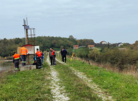
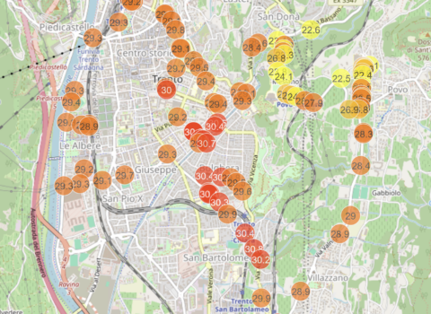
FBK’s 3DOM unit had carried out an analysis (focused on Trento) for mapping Urban Heat Islands (UHI) by processing from satellite images (Landsat and Sentinel) the LST – Land Surface Temperature, which is the direct measurement of the Earth’s surface temperature detected by the satellite’s thermal sensor. This processing, using weather stations present in cities and data taken by mobile sensors as the satellite passes over the city, has enabled the creation of heat island maps (UHI) in urban areas.
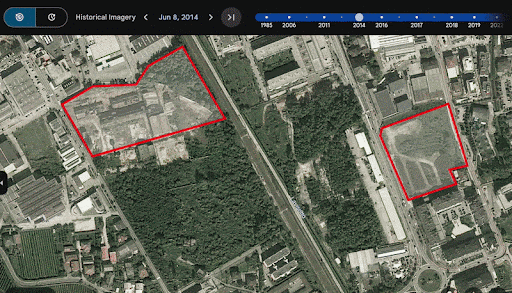
Land use change 2014-2024 on the two sites of interest
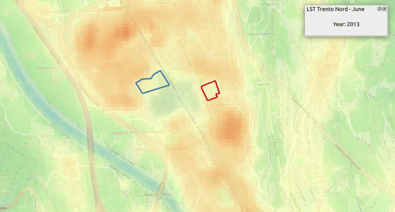
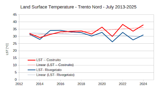
Median Surface Temperature – LST – June 2013-2025
The project has entered a more advanced stage through collaboration with the MTSD unit at the Foundation’s Center for Sensors & Devices. The project’s scope has broadened: it no longer focuses solely on identifying the hottest urban areas using satellite data and ground-based sensors. It now aims to correlate air temperatures with critical pollutant data, including ozone, nitrogen dioxide, and carbon monoxide.
At the core of this new phase are AI algorithms that enhance the spatial resolution of satellite data, enabling the creation of detailed, high-precision thermal maps. This development was made possible through a neural network trained on data collected via infrared-equipped aerial flights. The images obtained during these flights were integrated with satellite data to train the neural network model. The activity is part of the European USAGE project, which focuses on leveraging advanced technologies to make geospatial data more accessible and useful for urban monitoring and climate change mitigation.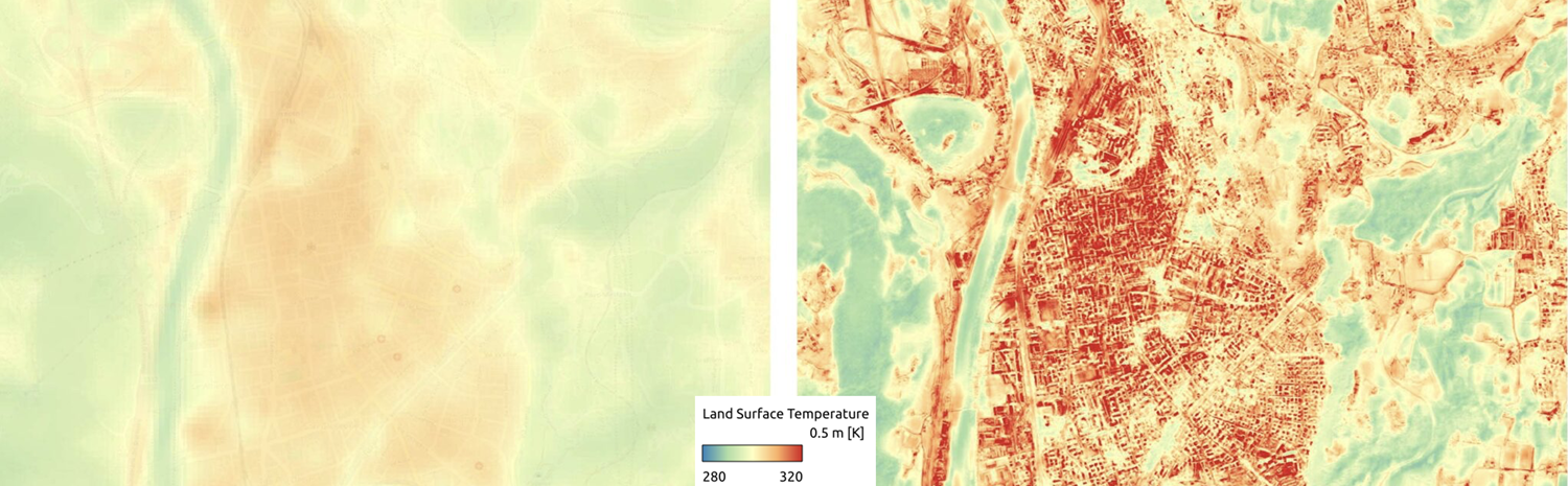
The neural network’s results were validated by comparing its temperature predictions with on-the-ground measurements from weather stations and mobile devices.
This approach enables the transformation of satellite data into precise, high-resolution air temperature estimates (at a 1-meter resolution), overcoming the limitations of conventional 30-meter resolution measurements.
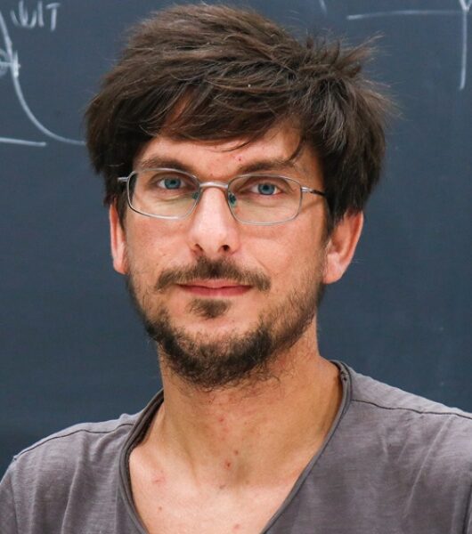
“The model we developed integrates a wide range of heterogeneous information,” Raniero Beber, a researcher at the FBK Center for Digital Industry’s 3DOM explained. “In addition to satellite images and thermal data, it incorporates variables such as soil emissivity, building density, vegetation cover, and other environmental characteristics that affect the distribution of heat in urban areas. The result is a detailed map of perceived urban temperatures—a valuable tool for identifying the most vulnerable areas and for planning targeted mitigation measures.”
The next phase of the project focuses on linking high-resolution air temperature maps (different from the LST measured by the satellite’s thermal sensor) with the spatial distribution of air pollutants in urban environments. To achieve this, a new measurement campaign is planned using sensor devices developed by FBK. These devices are capable of detecting concentrations of pollutants like ozone and carbon monoxide in real time.
“Pollutant data collected by satellites produce maps with coarse spatial resolution, which fail to capture local dynamics within cities,” notes Andrea Gaiardo, a researcher at the MTSD unit. “Our measurement campaign will help determine whether our mobile sensor devices can be used to generate a fine-grained, high-resolution map—both spatially and temporally—of air pollutants.”
Just as with air temperature data, the collected pollution data will be processed using AI algorithms to generate accurate pollution and air quality maps. These maps will then be integrated with UHI data. This combination of information marks a significant advancement in understanding the interplay between pollution and heat phenomena in urban settings, providing a foundation for more targeted and effective urban policy decisions.
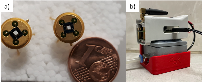
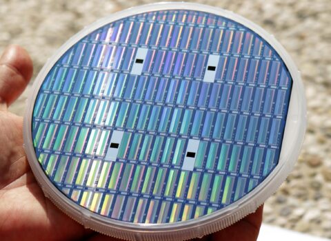
a) Chemoresistive gas sensors developed at FBK b) Gas sensor module produced and tested during the TernAria project
Practical examples of mitigation measures include replacing ground surfaces made of heat-retaining materials like asphalt and concrete with more sustainable alternatives. Other interventions include green roofs, which reduce ambient temperatures by absorbing less heat and promoting evapotranspiration, and evaporative surfaces that help cool the surrounding environment. Combined with strategic urban planning, these measures can effectively counter rising urban temperatures and improve livability during extreme heat events.
Thanks to the collaborative work of a multidisciplinary team from the 3DOM and MTSD research units, the project stands as a tangible example of how artificial intelligence and environmental data can be integrated to design cities that are more resilient, healthier, and better equipped to meet the challenges of climate change.
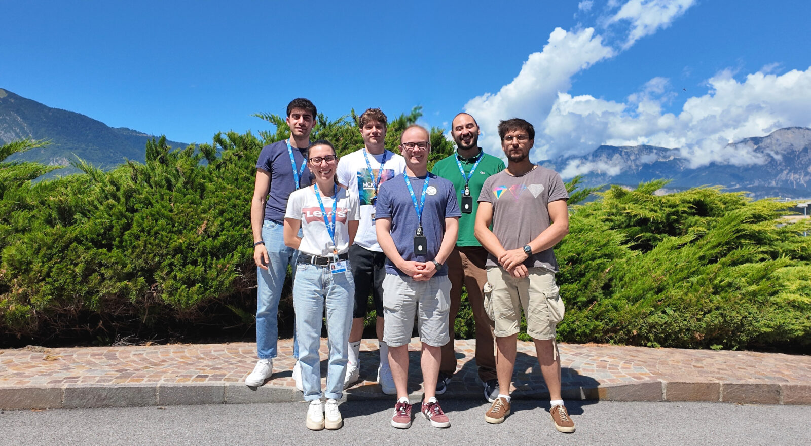
Cover foto:
Back row Antonio Orlando – Christian Stefani – Matteo Valt
Front row: Giada Bombardelli – Andrea Gaiardo – Raniero Beber
The author/s
Related articles