
Heat islands in Trento: mapping them to design the city of the future
September 18, 2024
An FBK project to create detailed temperature maps, helping the city make targeted decisions on climate change.
Climate change is transforming the environment and redesigning tomorrow’s places. In Italy, we just had the second warmest August since the 1800s with an average temperature 2.4 C higher than the 1991-2020 reference period. In order for future society to develop as well as possible, careful choices regarding our host environment must be implemented now. For this reason, analyzing the land in an increasingly accurate and specific manner is crucial for planning appropriate policies.
FBK’s 3DOM unit is conducting a Trento-focused analysis to identify Urban Heat Islands (UHIs), i.e. heat islands in the urban environment, and deliver detailed maps to policy makers and residents. These maps, which are also predictive, make it possible to assess what changes to make within cities and what benefits there may be for the urban environment and, consequently, for the local community.
In order to make these maps, it was necessary to monitor the city’s temperature in depth, so not only at the points where the weather stations are located, but more widely across the local area through integration with data from different sensors.
A first source of data was collected through the Meteo-tracker device, a portable weather station, which allows air temperature to be measured along with other meteorological parameters. Another source of data are satellites whose thermal infrared bands provide widespread measurement of ground temperature on a large scale in a single instant.
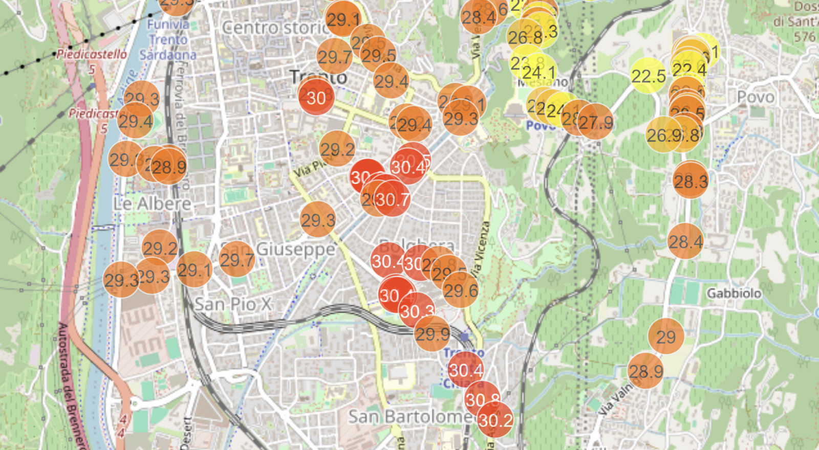
As Raniero Beber, a researcher in the 3DOM unit of FBK’s Center for Digital Industry explains and shows us in the video, the data acquired in Trento using the Meteo-tracker device revealed some interesting differences: for example, along waterways such as the Adige or the Fersina rivers, the temperature is lower by as much as 3-4 degrees in a similar way to more vegetated areas; moving instead toward the built-up area or into densely populated areas, the temperature rises and then falls again when climbing toward the hills of Povo and Villazzano.
The integration of these different data sources makes it possible to refine the time series of acquisitions, both spatially and temporally, thus allowing for the monitoring of temperature trends in the city and the production of an updated, high-resolution heat map of Trento. Thanks to it, thus, it is possible to identify and monitor heat islands.
By processing the data collected and sharing these maps of heat islands in the urban environment, policy makers and the public can take mitigation actions, including assessing the possible benefits before going on to make changes to the urban landscape.
Concrete examples of mitigation actions include replacing ground covers made of materials with high heat storage capacity, such as asphalt and concrete, with more sustainable alternatives. Or the use of green roofs, which help reduce the ambient temperature due to their ability to absorb less heat and promote evapotranspiration, and the implementation of evaporative surfaces that help cool the surrounding environment are effective solutions to counter rising temperatures in urban areas.
The methodology for the creation and validation of Urban Heat Islands implemented by the 3DOM unit on the city of Trento was carried out as part of the European project USAGE. The purpose of USAGE is to support pilot cities – Ferrara in Italy, Graz in Austria, Leuven in Belgium and Zaragoza in Spain – in implementing and complying with European Green Deal policies within their urban planning and improvement actions. For example, as for energy efficiency, management of climate change events (such as heat waves or flooding from heavy rainfall), and urban biodiversity monitoring, actions were proposed to be implemented to achieve positive changes for the urban area. All these actions and their benefits were presented to policy makers through the data collected, processed and commented on by the USAGE project partners. This enabled these pilot cities to evaluate, on the basis of accurate data studies, which actions to implement to improve the urban area and thus design the city of the future, taking into account climate change.
The author/s
-
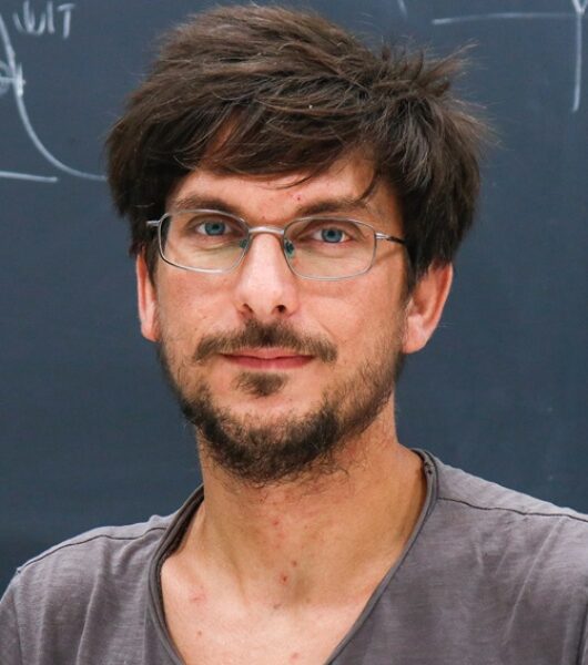 Raniero Beber
Researcher 3DOM unit Center for Digital Industry, FBK
MORE INFO
RELATED VIDEO
-
Videointervista Raniero Beber, researcher 3DOM unit, Center for Digital Industry
Related articles