


Underwater 3D Surveying
November 23, 2017
Documenting, mapping and monitoring the underwater world with photogrammetry
Our planet is also known as the Blue Planet, the color given to it by the large presence of water which covers it for more than 70%, essential to life and of which our bodies are composed for more than half. We cannot breathe underwater but we owe to oceans one out of two breaths because it is thanks to the oceans, producers of 50 to 70% of the oxygen present on our planet, that life exists.
Despite the fact that water is so important to us, vital to life, and up to the early last century, the only physical way to commercially and culturally link different countries, it encloses or covers spaces that are still completely unknown to human beings, hiding ithem to their eyes that cannot see directly underwater.
Oceans, lakes and rivers, still partially explored, retain traces of our past, enclosing important energy, natural and cultural resources that must be protected, but that first of all act as litmus test for the state of health of our planet.
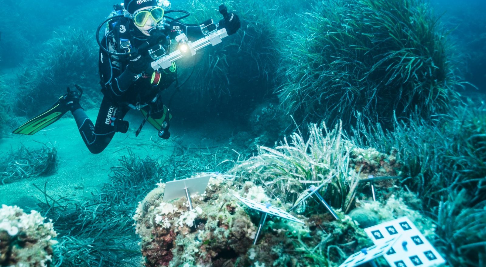
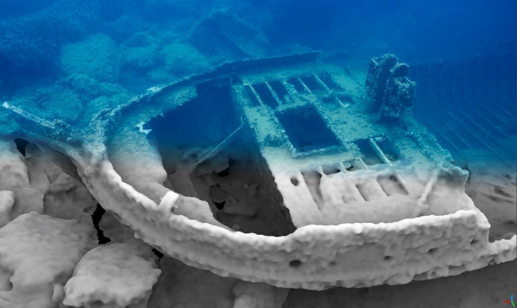
Among underwater exploration techniques available today to scientists, engineers and other operators, underwater photogrammetry is one of the most versatile and functional solutions for threedimensional (3D) mapping, measuring, diagnosing and monitoring the underwater world.
Underwater photogrammetry is a technique that, through image analysis, enables the 3D digital rendering of all that is “observed” by the underwater camera, thus allowing computer-based metric analysis useful for science, engineering and other purposes.
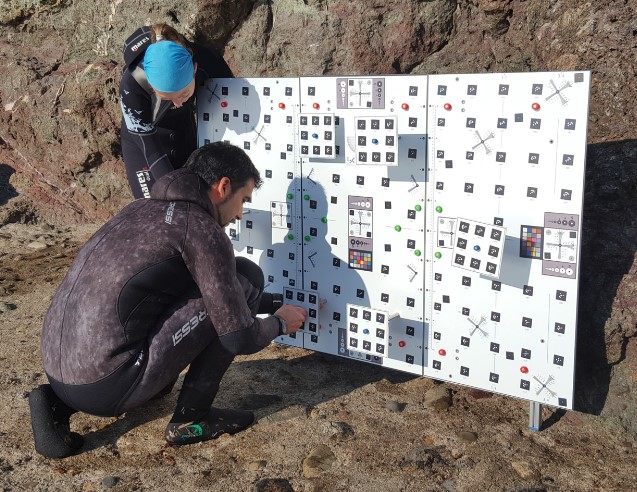
Underwater photographic acquisitions can be made by experienced divers or by using robots controlled remotely or autonomously (ROVsor AUVs). The underwater environment influences how images are created, as water diverts optical beams in a way that is not entirely predictable. In addition, the equipment must be suitably protected with waterproof diving cases.
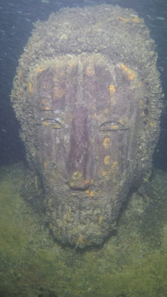
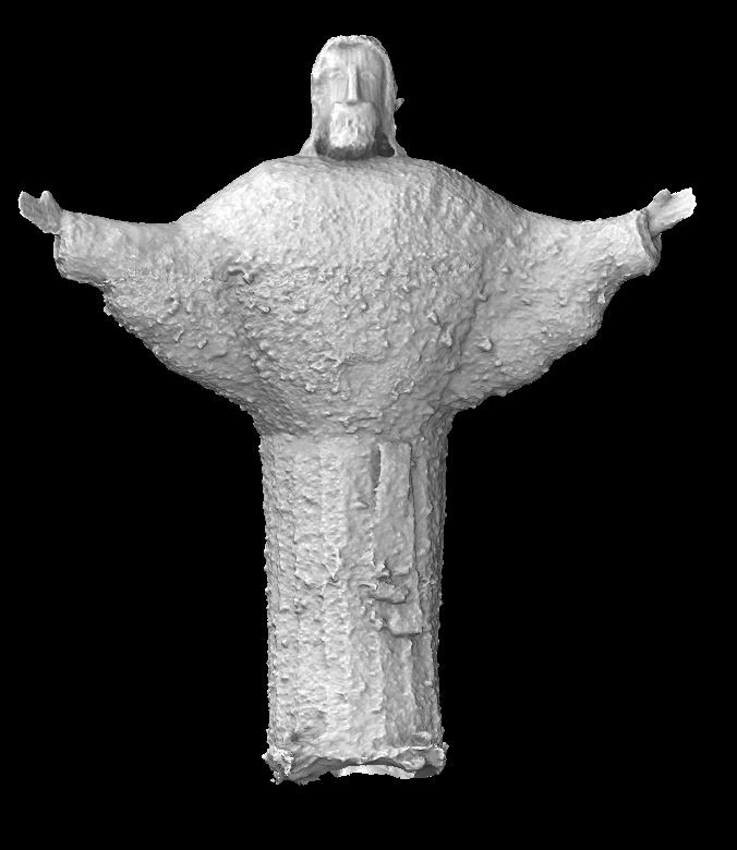
The 3DOM Unit has been conducting some research in collaboration with colleagues from national and international institutes for some years. “Through tests carried out in the laboratory, in the swimming pool, in Trentino lakes or at the sea, the unit is developing methods to allow for more accurate 3D measurements and rigorous replicable biological, archaeological and industrial solutions, ” Fabio Menna, a researcher with FBK’s 3DOM unit says. This will allow, for instance, to scientifically map the distribution of foreign species in the Trentino lakes, provide 3D documentation of sunken relicts or old commercial cargoes, track the health of benthic species on the Antarctic sea floors, map unexploded explosive devices, and so on. Even some Italian underwater camera producers have decided to support these activities, to the end of refining their products for scientific applications.
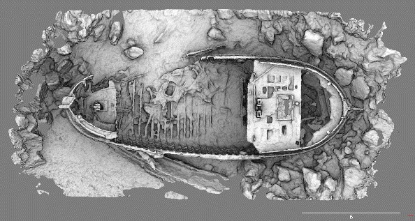
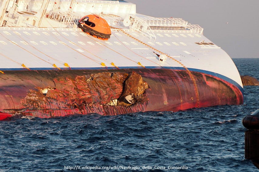
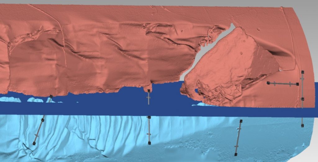
Among the various activities carried out by 3DOM, let us recall the underwater photogrammetry 3D survey of June 2012 of the crack of MV Costa Concordia, in collaboration with the research team of Prof. Troisi from the Parthenope University of Naples. Researchers applied for the first time a procedure they developed to render the damaged section with a resolution of a few millimeters, half of it out of the water and half immersed up to a depth of 6 meters. Diving for a week in the waters of the Giglio Island, 3D images of the hull were acquired with the support of the diving group of the Italian Navy. The study supported the legal investigation into the dynamics of the ship accident.
The author/s
-
 Fabio Menna
Researcher @ 3DOM (3D optical metrology) research unit
MORE INFO
RELATED VIDEO
-
3D relief
Related articles