

AI and advanced sensors for intelligent road monitoring
June 24, 2026
A new system developed by Edilpavimentazioni and FBK detects cracks and other road surface defects.
Digitizing road infrastructure to make monitoring and maintenance faster, more accurate, and more sustainable:
this is the goal of a project developed by Edilpavimentazioni S.r.l. together with the 3DOM research unit of FBK’s Center for Digital Industry as part of the EDIH-SoE InnovAction initiative. The project integrates advanced sensors, 3D reconstruction, and artificial intelligence algorithms for the automated analysis of road surface deterioration.
Active in road construction and paving, the production and sale of asphalt mixtures, and the rental of specialized vehicles, Edilpavimentazioni identified the digitalization of monitoring activities as a strategic way to improve the efficiency of maintenance operations and reduce their environmental impact.
From data collection to automated analysis
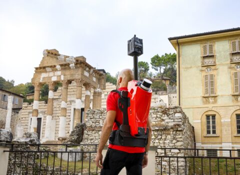
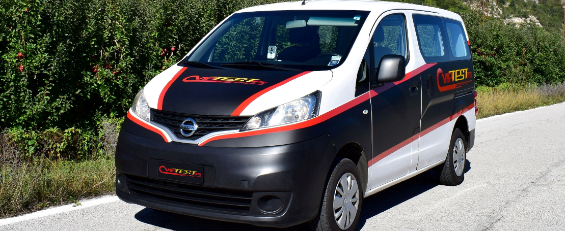
The project, developed as part of InnovAction’s Twin Transition – PoC service, builds on the company’s proprietary Viatest RPS system. The original version was already capable of collecting key information for infrastructure maintenance, including the International Roughness Index (IRI), longitudinal and transverse slopes, road geometry, and roadway video. The system integrated GNSS receivers, inertial measurement units, laser profilometers, cameras, and odometers mounted on a commercial survey vehicle.
The Viatest RPS system
The data collected made it possible to assess pavement conditions, but identifying road defects still required a lengthy and costly manual review of the recorded video.
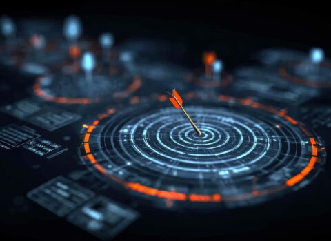
To address this need, the new System 2.0 was developed with the scientific support of FBK’s 3DOM Unit to automate the detection and geolocation of cracks, potholes, subsidence, and other road defects using advanced photogrammetry and artificial intelligence techniques.
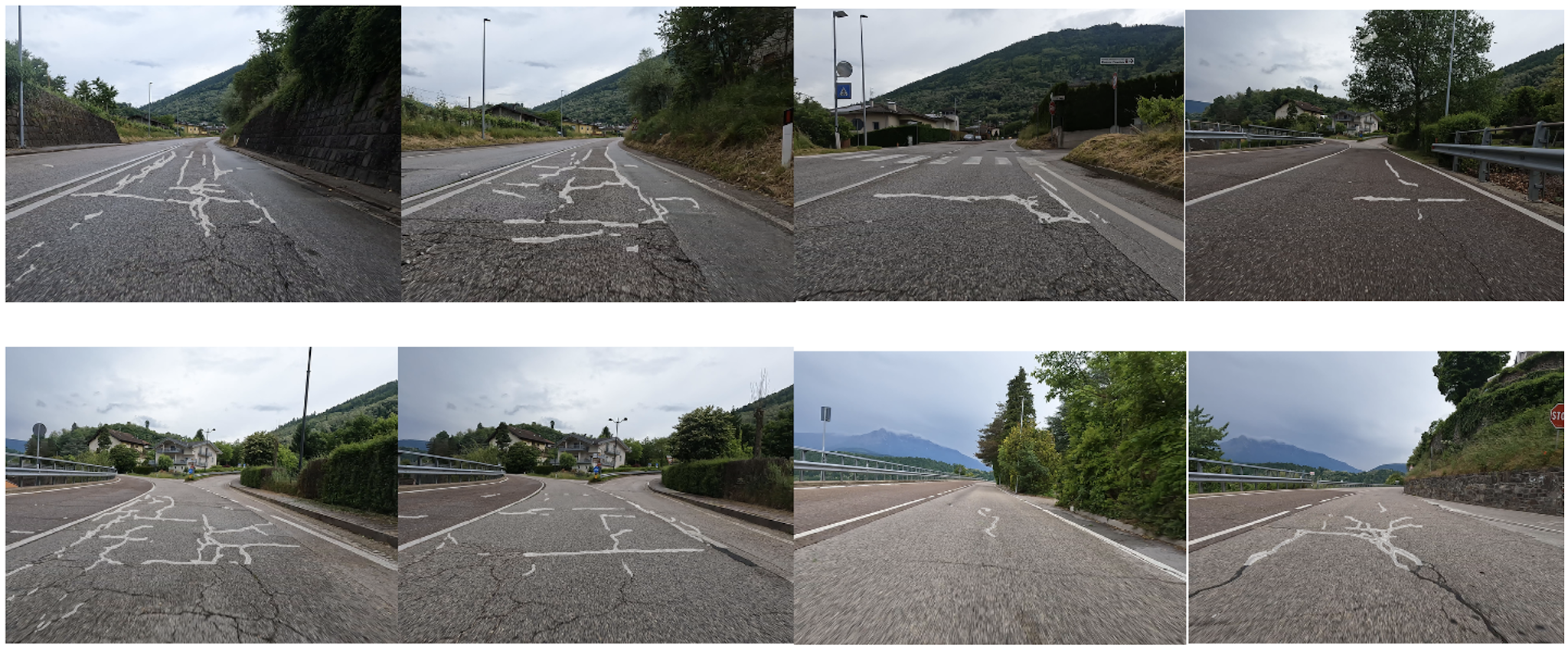
Examples of road surface deterioration (pavement cracks) identified by the Edilpavimentazioni survey system
Stereo Sensors, 3D Reconstruction, and AI
The project was carried out in four phases.
The first phase focused on the technical assessment of the existing system, with special attention to the quality and integration of data collected by the onboard sensors. The next phase evaluated the development of a new stereo vision system based on two cameras, capable of reconstructing the road scene in greater 3D detail and providing more accurate measurements of surface damage.
At the same time, software based on SLAM (Simultaneous Localization and Mapping) technology was developed to process the video sequences collected by the survey vehicle. The system generates georeferenced 3D models of the roadway and recognizes features in the surrounding environment, including vertical and horizontal road signs, manhole covers, utility access points, and road surface defects. It uses artificial intelligence models trained on annotated datasets provided by the company, covering different types of pavement damage and urban infrastructure.
Finally, a data fusion pipeline was developed to combine images, laser scans, and mapping data, enabling the automatic mapping and precise localization of road defects.
More accurate monitoring and more sustainable maintenance
Testing of the new System 2.0 demonstrated significant improvements over the original configuration. In particular, the new architecture provides more accurate and stable positioning, even in challenging environments such as underpasses or areas with limited satellite coverage, thanks to the integration of dead reckoning and photogrammetry techniques. The resulting trajectories are more consistent and repeatable over time, enabling reliable mapping of road network conditions. At the same time, automated defect detection significantly reduces the need for manual video review, speeding up the inspection process and helping operators identify critical areas more quickly.
The project is a concrete example of the twin transition applied to infrastructure. On the one hand, it accelerates the digital transformation of monitoring and maintenance processes; on the other, it enables the company to become more competitive and offer advanced services that benefit municipalities and road infrastructure operators.
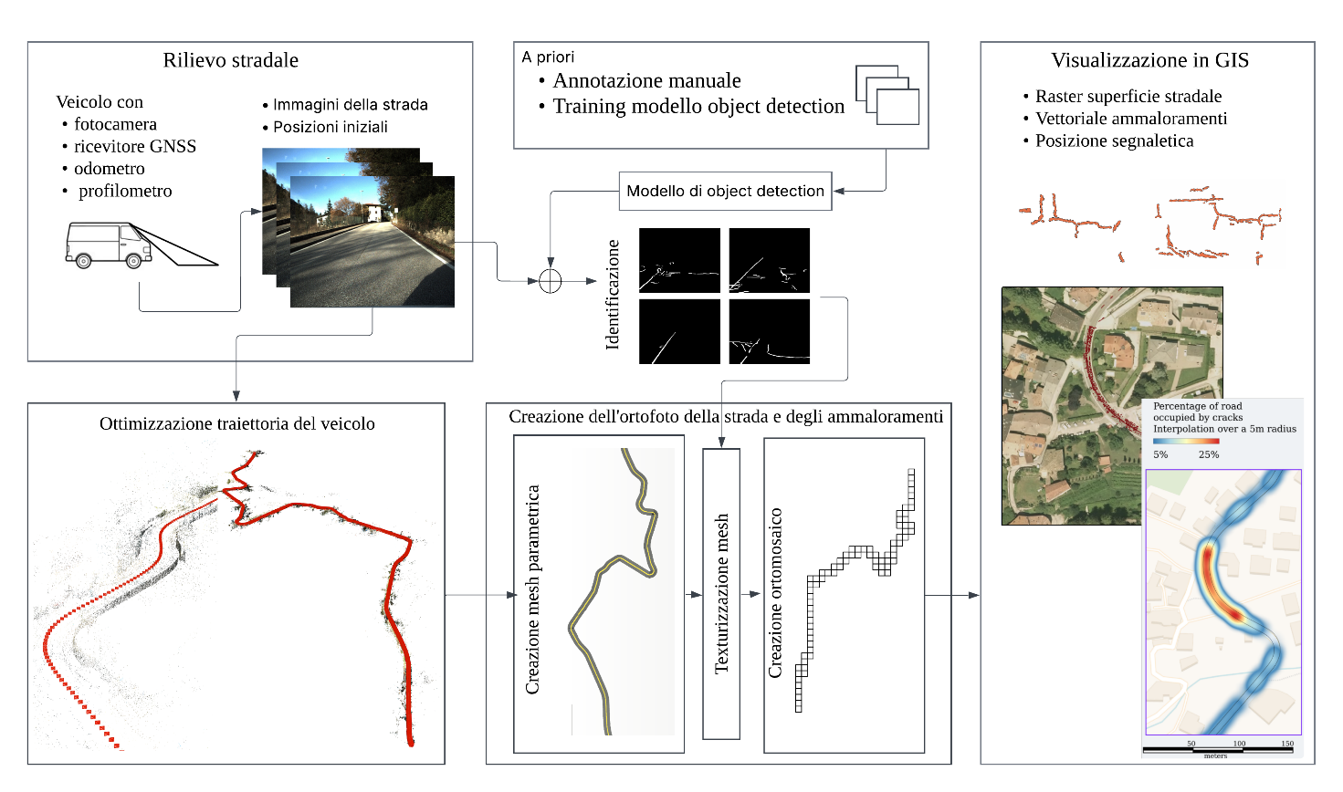
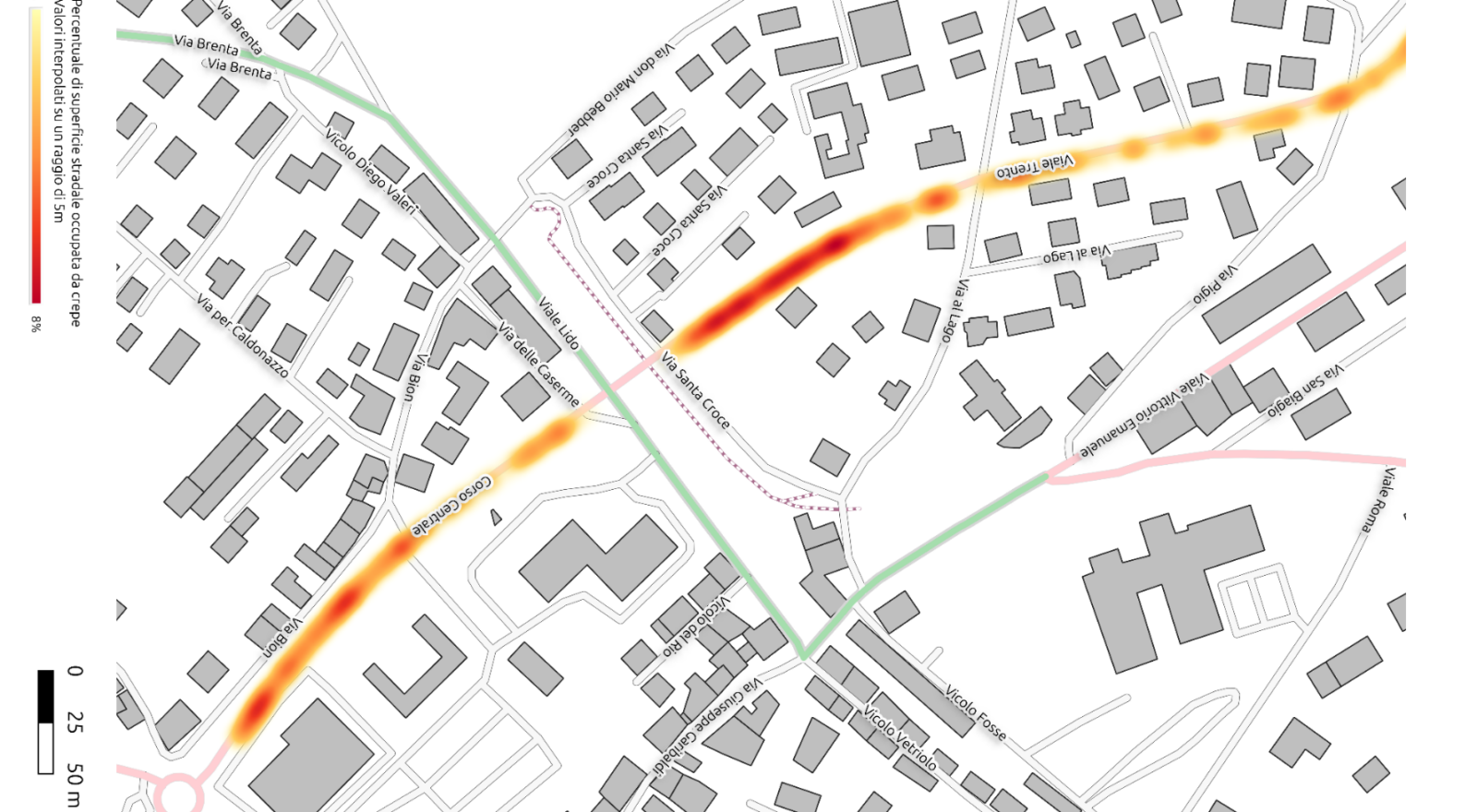
Data processing pipeline for generating georeferenced maps of road surface deterioration.
The author/s
Related articles