Multispectral Imaging for Precision Agriculture
August 2, 2017
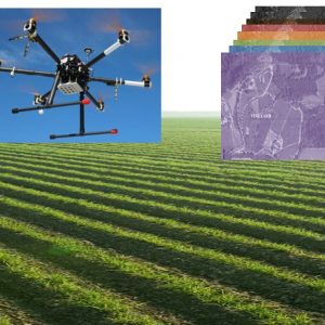
A special camera designed to fly on drones and able to produce multispectral images for use in agriculture and environmental monitoring.
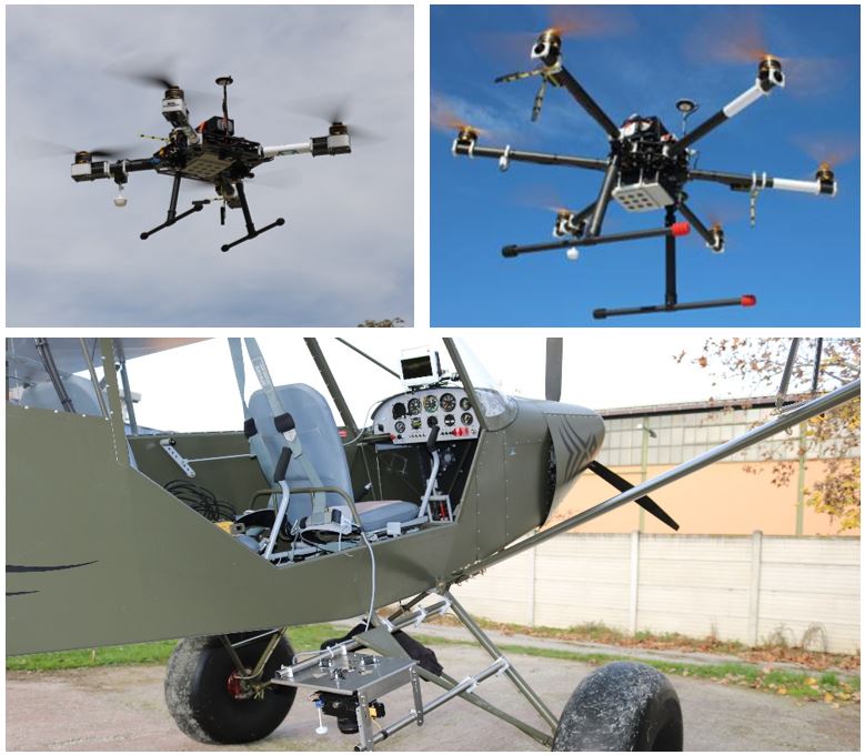
 The next-generation device, which allows images to be taken for specific electromagnetic spectrum bands, was developed thanks to a collaboration between researchers from Trento based Fondazione Bruno Kessler, EOPTIS and SAL Engineering. Its applications range from the so-called precision agriculture to vegetation mapping, to the detection of pollutant spills.
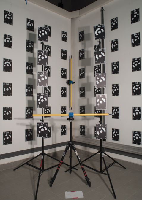
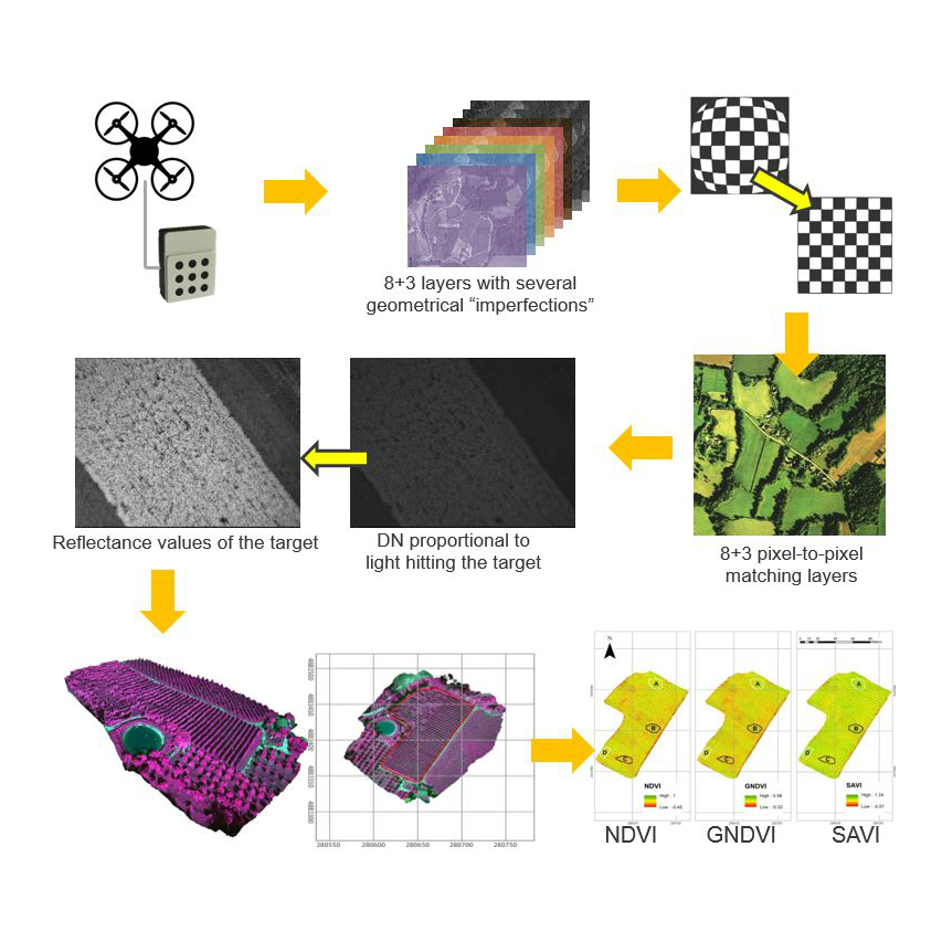
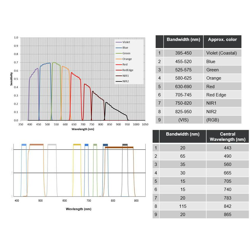
“Fondazione Bruno Kessler,” Fabio Remondino, Head of the 3DOM FBK Research Unit says, “provided support with camera architecture definition, with sensor and lens filter wavelength configuration, and above all, with the development of the dedicated software to manage and process the images obtained during flights. A camera of this kind allows to capture images in many spectrum bands, each of them characterized by a different capability to reflect ground incident radiation. In this way we can distinguish the different types of soil tops and, in particular, determine the state of development and health of the vegetation. At this time, the camera is available in two versions with different filter sets that, together with the software, are already on the market. Before selling it, every camera comes into our labs where we perform a geometric calibration of the sensors and lenses to allow more accurate image processing. EOPTIS and SAL Engineering requested to collaborate with us thanks to our experience in imaging, 3D and drone surveys. The project is an example of how fruitful interdisciplinary collaboration between research and industry can transform embryonic ideas and products into commercial and competitive results. ”
The author/s

-
 Fabio Remondino
Head of Unit 3D Optical Metrology (3DOM), Digital Industry Center -FBK
MORE INFO