
Crime in large cities: different cities, different causes
September 3, 2020
The new study led by researchers Marco De Nadai and Bruno Lepri with FBK's Mobile and Social Computing Lab that explores the correlation between crime, socioeconomic conditions, environment features and mobility in 4 megacities has been published in "Nature Scientific Reports". Findings show how the variability of the dynamics and the history of each city make it very difficult to suggest universal recommendations to reduce crime
23% of the world population lives in megacities today. In these huge cities, criminal activity is much more intense and violent than in smaller ones or in rural areas. Understanding which factors influence urban crime is therefore an urgent need.
Influential past studies have analyzed crime rates through historical data or through ecological factors that can influence crime. For example, certain places such as bars can attract crime, but at the same time they can be part of a virtuous mechanism that decreases the isolation of the area and, therefore, crime itself. New AI-based machine learning methods have also recently provided accurate predictions of crime over time. However, the majority of existing studies focus on a single city at a time, often New York or Chicago, and only consider a limited number of factors, such as socio-economic characteristics, while ignoring others, such as people mobility. Therefore, our understanding of the factors influencing crime in cultures and cities is very limited.
In the new study conducted by Fondazione Bruno Kessler in cooperation with some researchers of the University of Berkeley and Data-pop Alliance, published by the prestigious journal Nature Scientific Reports, an innovative model is proposed to explore how violent and non-violent crimes are related not only to socio-economic factors, but also to environmental features related to urbanization (e-g. land use) and the mobility of people between neighborhoods.
To this end, FBK researchers integrated multiple open data sources with cell phone traces to understand how different factors are related to crime, and comparing them in different cities, namely Boston, Bogotá, Los Angeles and Chicago.
“This new approach has shown how the combined use of socio-economic conditions, information on mobility and physical features of the neighborhood effectively explains the emergence of crime and improves the performance of traditional approaches – Marco De Nadai, first author of the study, said – However, it also proved that the neiborhood’s socio-ecological factors refer to crime very differently from one city to another and that therefore there is not (yet) in fact a model suitable for every city as well as replicable”.
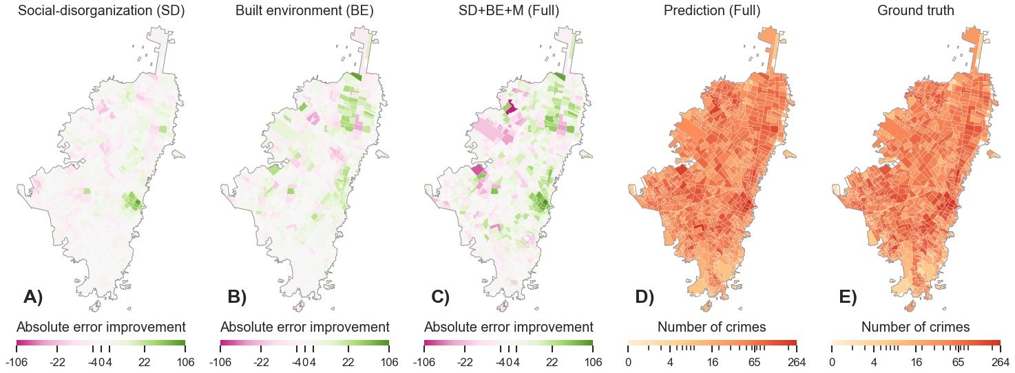
Map of crime estimation in Bogotá using only: A) socio-economic data; B) environmental and building data; B) model complete with mobility. D) forecast of the complete model; E) observed crimes.
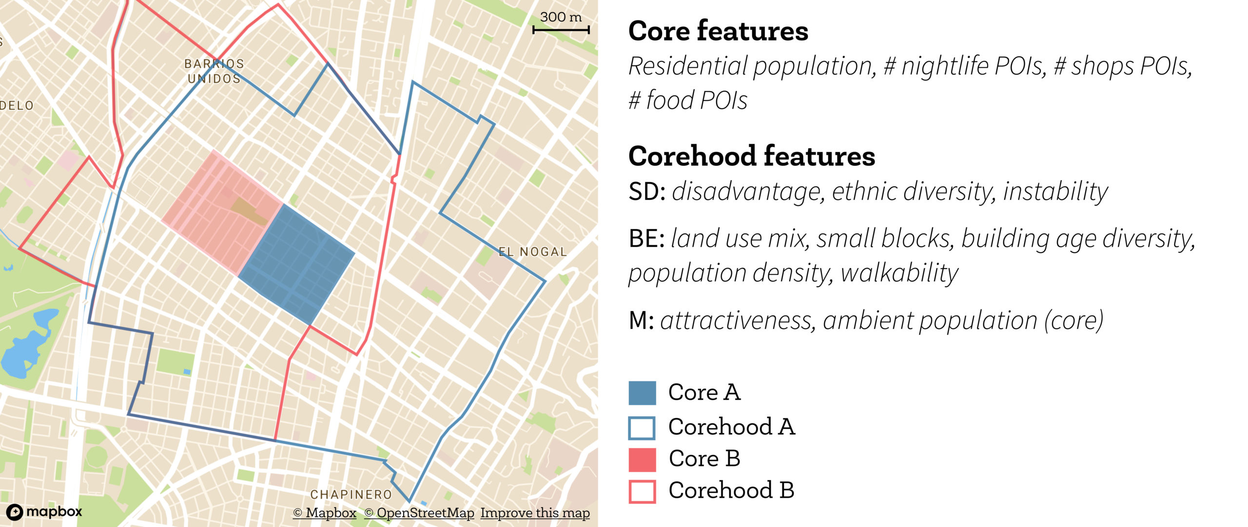
Crime is analyzed in areas large on average 0.378 km ^ 2 (blue and red squares). Different variables of place, called Core, and neighborhood (corehood), built from the area surrounding the Core, were extracted.